UWMN_27

Baddoch Burn
Baddoch Burn
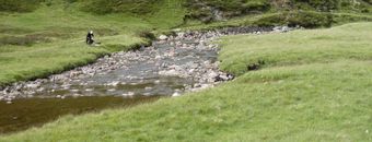
  • Location: Cairngorm Mountains, eastern Highlands, Scotland
  • Type: Stream
  • Catchment area: 2260 ha
  • Annual rainfall: 860 mm
  • Sampling station altitude: 415 m
  • Maximum altitude: 975 m

The Baddoch Burn has been monitored by Marine Scotland Science Freshwater Fisheries Laboratory since 1988. The site was added to the UK UWMN in 2013, extending the alkalinity gradient of sites within the Network as well as providing long-term high-quality chemistry and fish records that are directly compatible with measurements performed in other monitoring sites.

Catchment Characteristics

The Baddoch Burn lies in the Cairngorm Mountains of Scotland and forms part of the headwaters of the River Dee. The catchment area is 2260 ha and rises from 415m altitude at the long-term chemistry sampling and fish trap location to 975m at the summit of Carn a Gheodh. The 9.3 ha Loch Vrotachan lies in the southern section and the outflow feeds into Allt Loch Vrotachan before reaching the Baddoch Burn. Bedrock geology consists of Socach Quartzite and Schists (Tulaichean, Lochsie Calcareous and Clunie Graphitic) with areas of alkaline intrusions. Soils are predominantly blanket peats but range from rankers and subalpine podzols at high elevations down to humus-iron podzols in lower regions and a small area of brown earth at the bottom of the catchment.

There is a very small amount of commercial coniferous forestry at the lowest end of the catchment. Other land-use consists of extensive grouse-moor, with associated muirburn, and grazing by red deer. Loch Vrotachan is fished for Brown Trout.

The Burn forms the top of the River Dee Special Area of Conservation and the catchment lies within both the Cairngorms Massif Special Protection Area and the Cairngorm National Park.

Rainfall, recorded from nearby Braemar, is ca. 860 mm annually.

Site Characteristics

The altitude range is 560 m from the long-term sampling station to the headwaters. The 50m channel section utilised for diatom and macrophyte sampling is around 6m wide comprising shallow riffles with a small section of rapids at the bottom. Within the 50m diatom and macrophyte sampling section the upper stream bed substrate consists largely of boulders, cobbles and pebbles with the lower section rapids on bedrock. The Upper and Lower electrofishing sites are broadly characterised by boulders and cobbles, the Middle site is commonly used by spawning Atlantic salmon and is characterised primarily by gravel and cobble substrate.

Bibliography