- Location: Lake District, north-west England
- Type: Lake
- Catchment area: 602 ha
- Annual rainfall: c. 2200 mm
- Lake area: 23.9 ha
- Lake altitude: 253 m
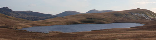
Despite the imposing backdrop of Burnmoor Tarn in the Lake District, only the lower fells usually form the catchment of the lake as the slopes of Scafell drain directly into Hardrigg Beck. The catchment is 602 ha in area and reaches a maximum altitude of 609 m.
The catchment receives an annual rainfall of c. 2200 mm.
To the north and west of the lake the bedrock is Ordovician andesite lava of the Borrowdale Volcanic series, to the south and east it is granite. There are thick till deposits in the catchment, notably on the southern side of the lake and the catchment soils are characterised by podsols and shallow peat rankers. The vegetation is mainly rough Agrostis-Festuca and Nardus grassland with Pteridium, Vaccinium, Calluna, and Sphagnum and is utilised for rough grazing by sheep and hill cattle. A ruined fishing lodge stands by the southern shore and a mediaeval corpse road ran past the eastern shore.
Both the lake and catchment are within the Lake District National Park and are owned by the National Trust. The whole catchment is designated common land and lies within an Environmentally Sensitive Area and a "Severely Disadvantaged" Less Favoured Area.
Burnmoor Tarn is the largest 'tarn' in the English Lake District. It occupies 23.9 ha and lies at an altitude of 253 m in a moraine hollow on the uplands between Wastwater and Eskdale. The lake has two distinct basins close to the south-eastern shore and a maximum depth of 13 m. There are four main inflow streams to the north and north-west. The outflow at the eastern end joins the Hardrigg Beck which drains the slopes of Scafell and, in times of especially high flow, is partly diverted into the lake across a braided delta.
The tarn has been designated as a site in the Environment Agency's Water Framework Directive Lake Surveillance Network. The UK UWMN contributes the biological and chemical data required for this statutory monitoring.
[collapsed title="Water chemistry"]
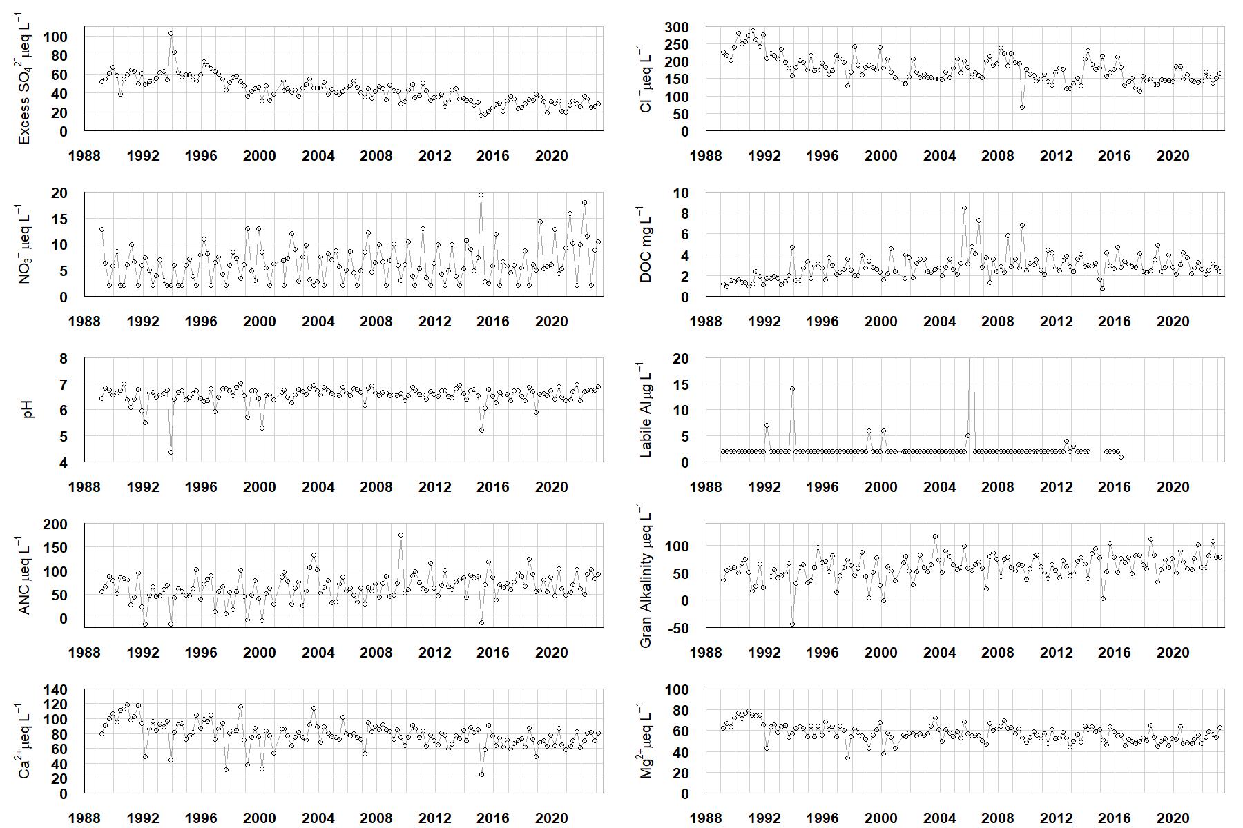
Excess SO42- = all sulphate not derived from marine salts; Cl- = chloride; NO3- = nitrate; DOC = dissolved organic carbon; Labile Al = inorganic monomeric (labile) aluminium; ANC = Acid Neutralising Capacity (determined by the difference (in equivalents) between total base cation concentration and total acid anion concentration); Gran Alkalinity = alkalinity determined by a Gran titration; Ca2+ = calcium; Mg2+ = magnesium.
[/collapse]
[collapsed title="Epilithic diatoms"]

Annual mean percentage abundance of the most common diatom taxa in replicate samples of the biofilm of stone surfaces. Taxa are arranged in the plot so that those that had their highest percentage abundances at the beginning of the monitoring record appear at the top of the figure, and those that have become most common at the end of the record appear at the bottom.
[/collapsed]
[collapsed title=Macroinvertebrates]
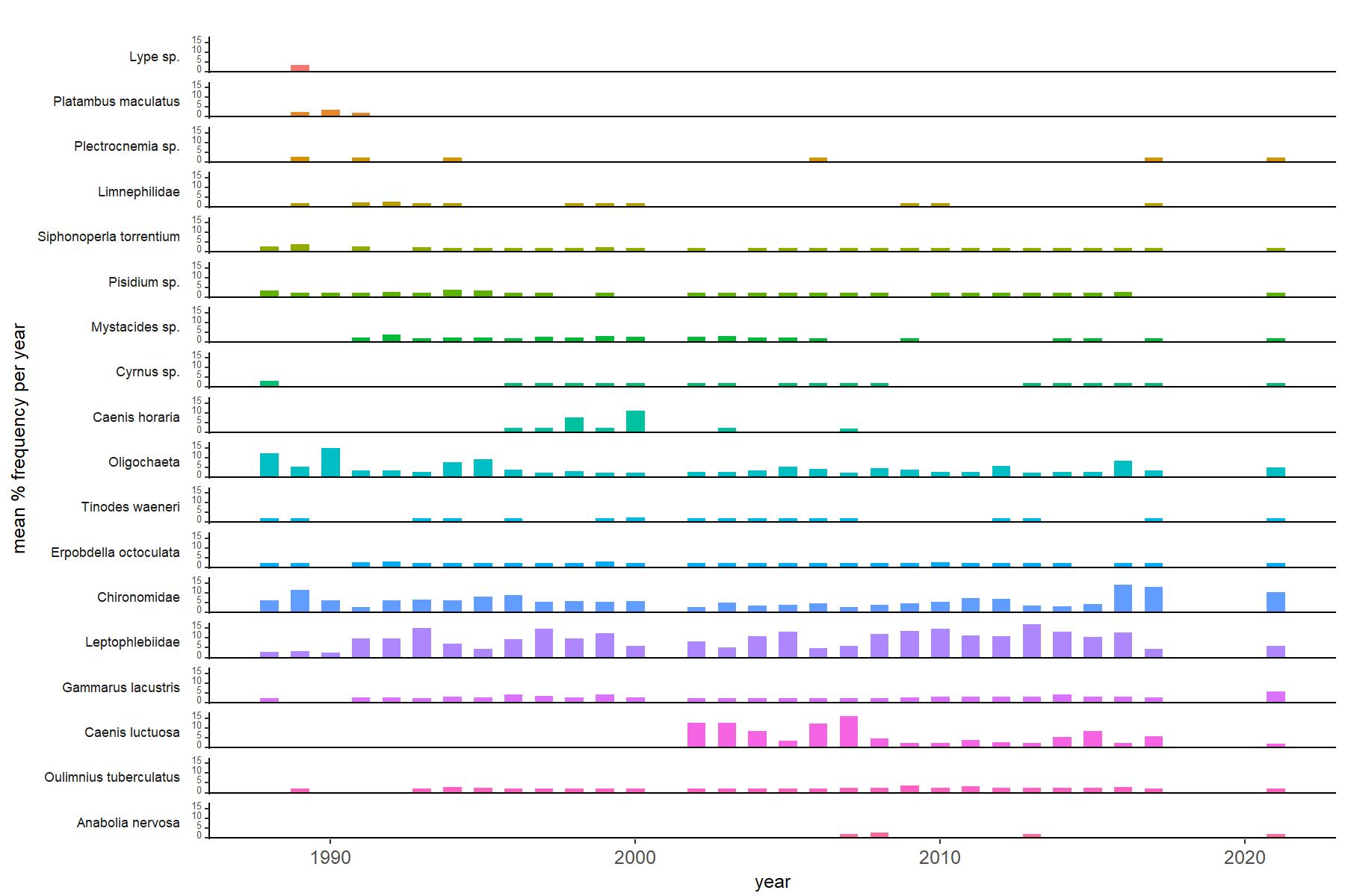
Abundance of the most common macroinvertebrate taxa as a percentage of all individuals collected in five bulked kick samples. Taxa are arranged in the plot so that those with their highest percentage abundances at the beginning of the monitoring record appear at the top of the figure, and those that have become most common at the end of the record appear at the bottom.
[/collapse]
[collapsed title=Burnmoor Tarn Bibliography]
[/collapse]