- Location: Galloway, south-west Scotland
- Type: Stream
- Catchment area: -
- Annual rainfall: c. 2400 mm
- Sampling location altitude: 260 m
- Maximum altitude: 716 m
The Dargall Lane catchment is a sub catchment of Loch Dee, Galloway, south-west Scotland. The catchment rises from 260 m at the sampling station to 716 m at Lamachan Hill. The underlying geology is complicated and includes Silurian and Ordovician greywackes, shales and mudstones, and granite/gneiss intrusions. Rankers are the dominant soil type covering some 80% of the catchment, with peaty podsols and subalpine soils comprising the remainder. The vegetation of this moorland catchment is characterised by Molinia and Calluna. Land-use was traditionally confined to low-intensity sheep grazing. In 2002 however cattle were introduced to a small area, away from the stream, at the bottom of the catchment.
Annual rainfall is c. 2400 mm.
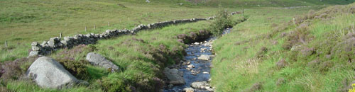
A straight section of stream approximately 4 m wide and characterised by a boulder and cobble substrate is utilised for biological sampling. Bryophyte cover is relatively high and the upper portion of the section has many riffles.
Bi-weekly bulk rainwater samples are collected from close to the site, at Loch Dee, for the UK Eutrophying and Acidifying atmospheric Pollutants (UKEAP) network (see UKEAP data for Dargall Lane).
The site also hosts the SEPA West gauging station number 80005. Data from the SEPA Dargall Lane station are submitted to the National River Flow Archive (see NRFA summary web page showing flows and catchment details).
[collapsed title="Water chemistry"]
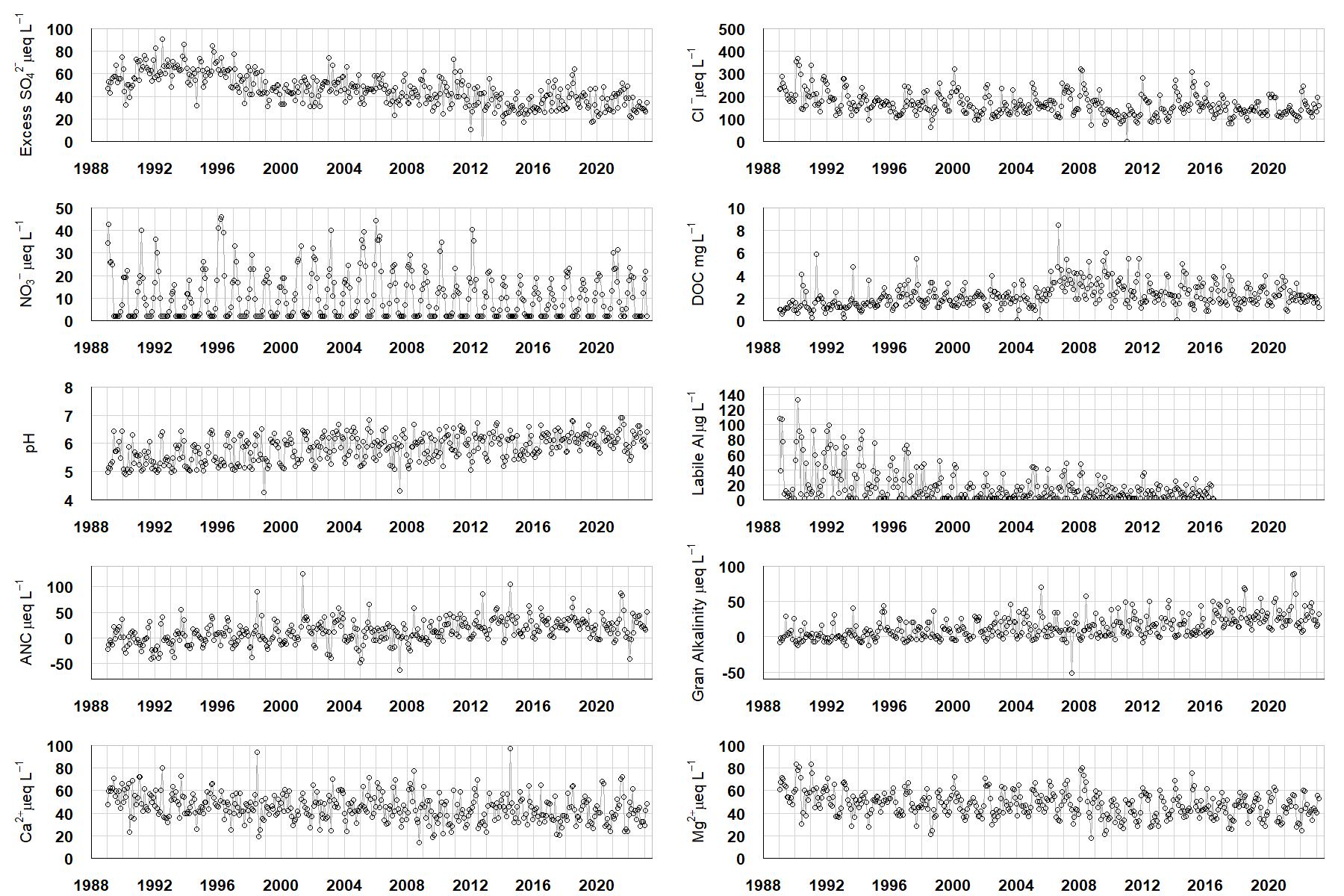
Excess SO42- = all sulphate not derived from marine salts; Cl- = chloride; NO3- = nitrate; DOC = dissolved organic carbon; Labile Al = inorganic monomeric (labile) aluminium; ANC = Acid Neutralising Capacity (determined by the difference (in equivalents) between total base cation concentration and total acid anion concentration); Gran Alkalinity = alkalinity determined by a Gran titration; Ca2+ = calcium; Mg2+ = magnesium.
[/collapse]
[collapsed title="Epilithic diatoms"]

Annual mean percentage abundance of the most common diatom taxa in replicate samples of the biofilm of stone surfaces. Taxa are arranged in the plot so that those that had their highest percentage abundances at the beginning of the monitoring record appear at the top of the figure, and those that have become most common at the end of the record appear at the bottom.
[/collapsed]
[collapsed title=Macroinvertebrates]
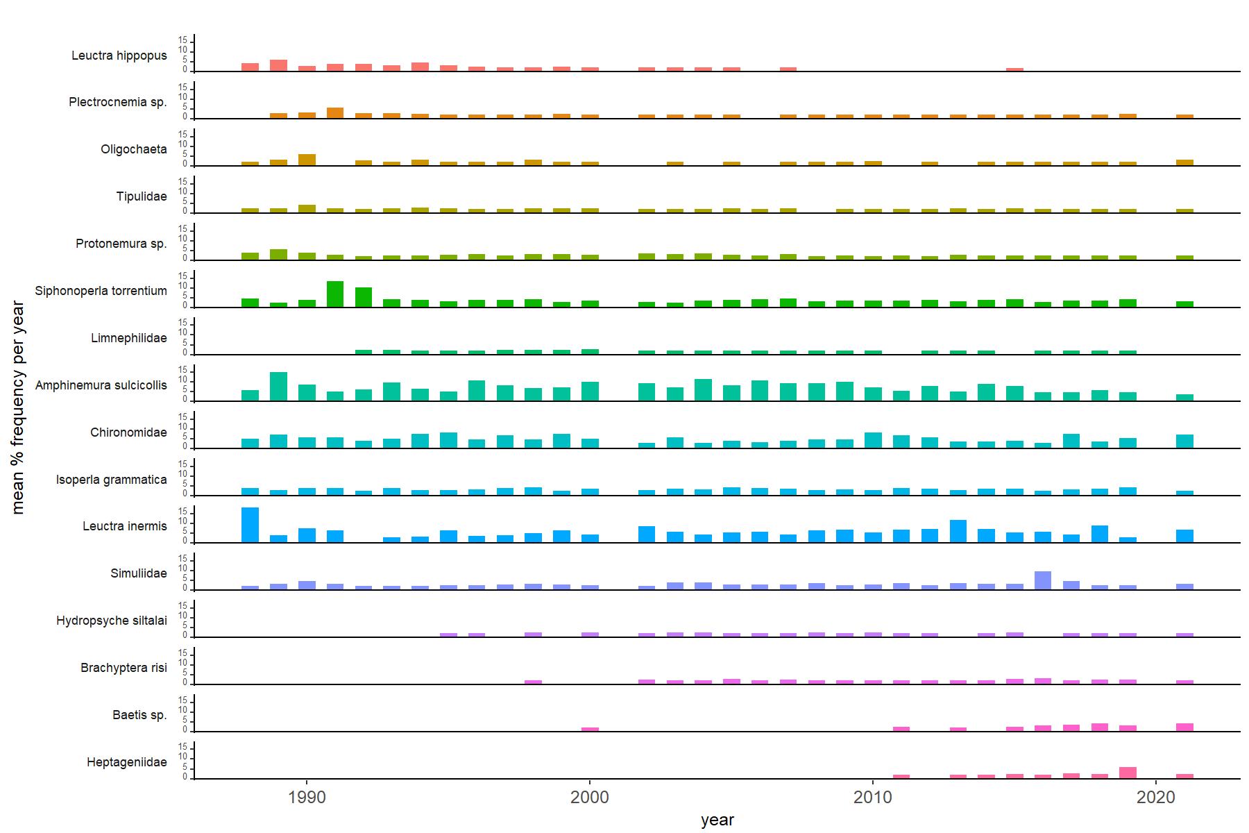
Abundance of the most common macroinvertebrate taxa as a percentage of all individuals collected in five bulked kick samples. Taxa are arranged in the plot so that those with their highest percentage abundances at the beginning of the monitoring record appear at the top of the figure, and those that have become most common at the end of the record appear at the bottom.
[/collapse]
[collapsed title=Dargall Lane Bibliography]
[/collapse]