- Location: Trossachs, central Scotland
- Type: Lake
- Catchment area: 1484 ha
- Annual rainfall: c. 2250 mm
- Lake area: 105.7 ha
- Lake altitude: 92 m
Loch Chon, in the Scottish Trossachs, drains an extensive catchment of 1484 ha with a maximum altitude of 600 m to the north-west. The geology consists of metamorphosed sediments of the Dalradian group (Cambrian). There are also belts of darker rocks, the 'green beds', which contain higher proportions of calcium and magnesium than the surrounding rock, but from the water chemistry they appear to supply little alkalinity to the loch. Catchment soils consist of peat gleys, non calcareous gleys, peaty podsols and humus iron podsols.
Annual rainfall is c. 2250 mm.
Most of the lower ground in the Loch Chon catchment has been planted with coniferous forest, although there is a small amount of deciduous woodland along the shores of the loch and the banks of the inflow streams. Sitka spruce predominates with some Norway spruce, Japanese larch, Scots pine and Lodgepole pine. Planting began in 1951 and continued throughout the 1950s and 1960s. Mechanical digging of drains or ploughing was not carried out in these early plantations due to the steep gradient of the slopes and thin soils, although areas planted recently (since 1980) have been ploughed. Nitrogen and phosphate fertiliser was applied by hand at the time of planting and again in the early 1960s when the first plantations were not growing well. At this time drains were also deepened by hand and the condition of the trees improved. Later applications of phosphate fertiliser were made from the air. Since monitoring began there have been some large areas of felling in the north west of the catchment and a smaller strip in the south west. Some of the north western area has been replanted and small amounts of new planting have occurred in the north.
The high ground in the Loch Chon catchment has a vegetation similar to that of the neighbouring catchment of Loch Tinker, characterised by Calluna and Molinia moorland. There is a small farm at the north end of Loch Chon. In 1960 the meadows around the farm were ploughed and potatoes and hay grass planted. Some lime and fertiliser were applied periodically to the hay meadows from 1960 to 1983 and a few cattle (less than 40) were also kept on this land, but in recent years the intensity of land-management in this area has declined. A small road passes through the catchment on the east side of the loch and a subterranean aqueduct, built in the nineteenth century to carry water from Loch Katrine to Glasgow, passes along the west side of the loch. Many of the inflow streams have been canalized where they pass over the aqueduct. Three of these inflow streams are included in a monitoring programme being carried out by the Marine Scotland. The loch and its catchment lie within the Loch Lomond and Trossachs National Park.
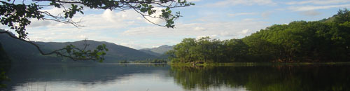
Loch Chon is a relatively large (surface area 105.7 ha) lake lying at an altitude of 92 m in the Trossachs region of central Scotland. The loch is fed by several small streams and drains to the south via Loch Ard and the River Forth. The loch has two main basins, with the deepest area (25 m) represented by a trench near the western shore. The bathymetry was first surveyed by Murray and Pullar in 1910.
Bi-weekly bulk rainwater samples are collected from close to the site for the UK Eutrophying and Acidifying atmospheric Pollutants (UKEAP) network, data from which are available.
Click on a heading to expand/collapse each panel
[collapsed title=Water chemistry]
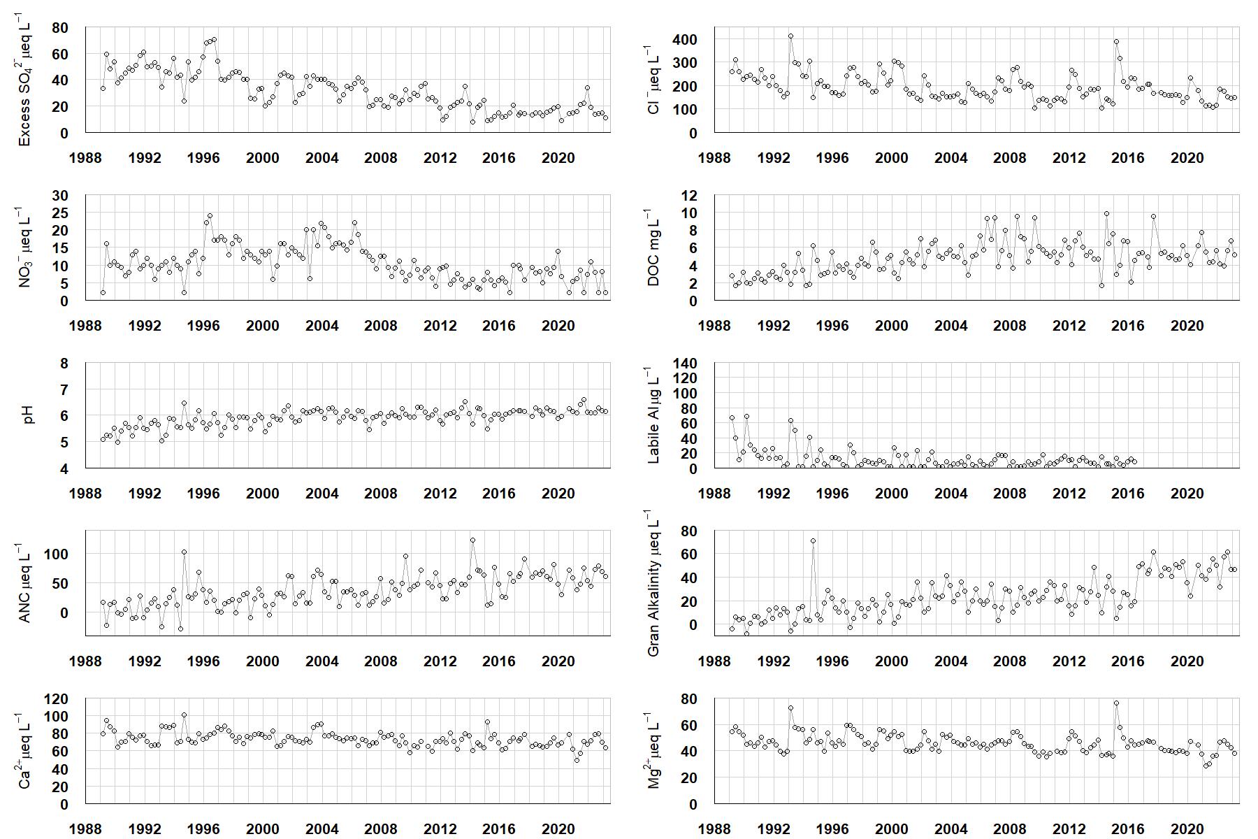
Excess SO42- = all sulphate not derived from marine salts; Cl- = chloride; NO3- = nitrate; DOC = dissolved organic carbon; Labile Al = inorganic monomeric (labile) aluminium; ANC = Acid Neutralising Capacity (determined by the difference (in equivalents) between total base cation concentration and total acid anion concentration); Gran Alkalinity = alkalinity determined by a Gran titration; Ca2+ = calcium; Mg2+ = magnesium.
[/collapse]
[collapsed title=Epilithic diatoms]

Annual mean percentage abundance of the most common diatom taxa in replicate samples of the biofilm of stone surfaces. Taxa are arranged in the plot so that those that had their highest percentage abundances at the beginning of the monitoring record appear at the top of the figure, and those that have become most common at the end of the record appear at the bottom.
[/collapse]
[collapsed title=Macroinvertebrates]
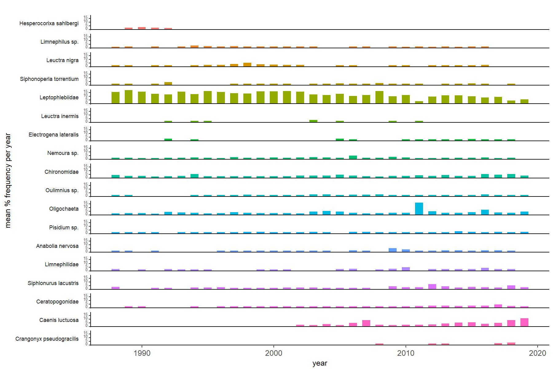
Abundance of the most common macroinvertebrate taxa as a percentage of all individuals collected in five bulked kick samples. Taxa are arranged in the plot so that those with their highest percentage abundances at the beginning of the monitoring record appear at the top of the figure, and those that have become most common at the end of the record appear at the bottom.
[/collapse]
[collapsed title="Bibliography"]
[/collapse]