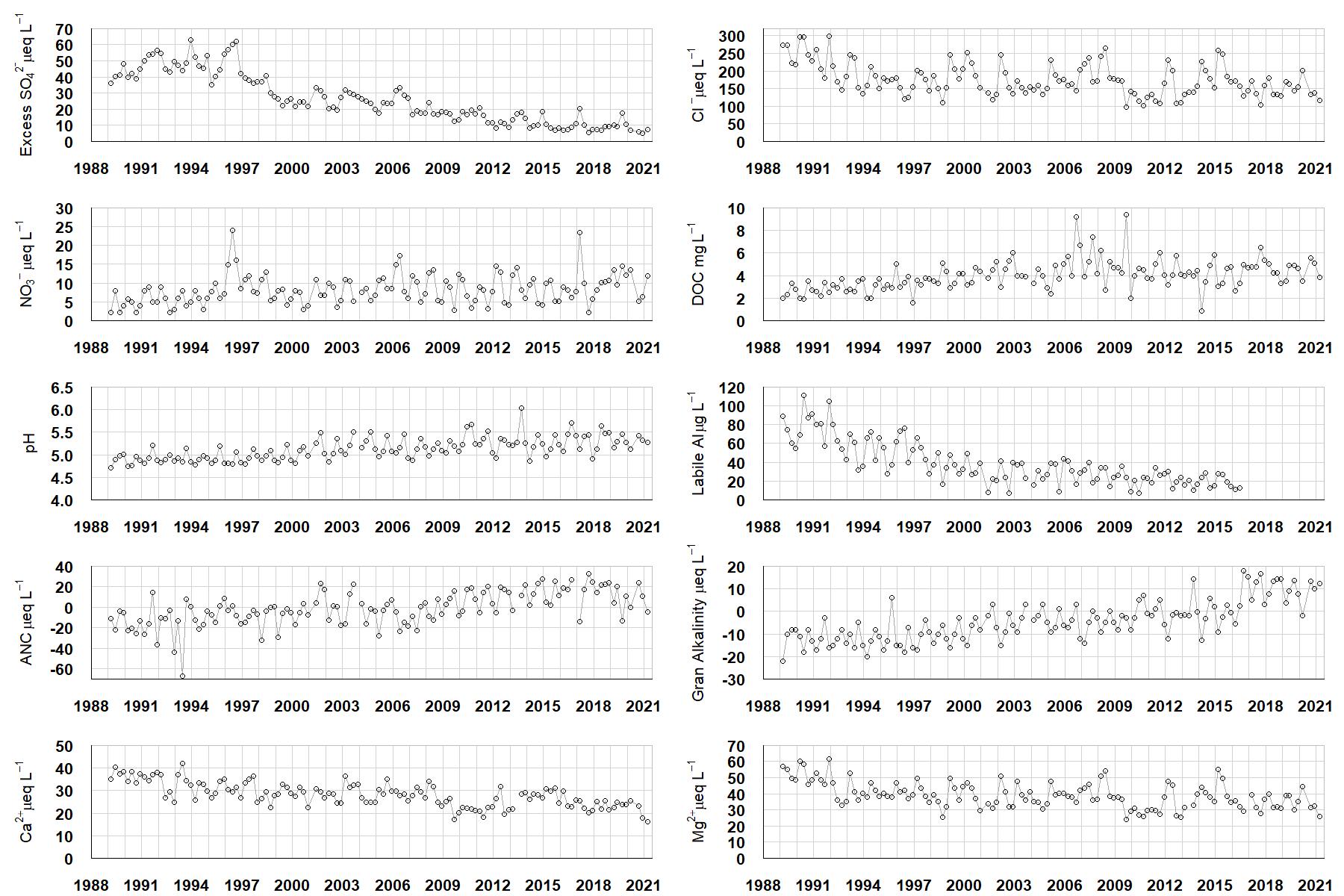
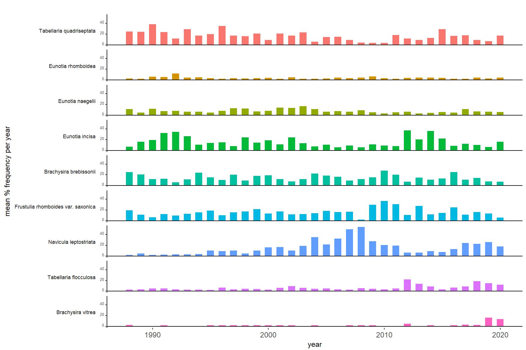
Plots of water chemistry data up to 2021, and epilithic diatom relative abundance data up to 2020, are now available for most sites.To view these, go to the Sites section, choose a site and scroll to 'Data plots'. Further data plots will follow shortly. The water chemistry figures show trends in water pH, Gran Alkalinity, Acid Neutralising Capacity and concentrations of excess (non-marine) sulphate, chloride, nitrate, dissolved organic carbon, inorganic monomeric (labile) aluminium, calcium and magnesium in filtered water. The diatom graphs show the annual mean percentage abundance of the most common diatom taxa in the biofilm of submerged stone surfaces. Refer to the Methods section for details of how data are obtained.
Here are some example figures, showing data for Round Loch of Glenhead.


The UWMN is hugely indebted to a dedicated group of volunteers responsible for the regular collection of water samples at the majority of UWMN sites. Water chemical analysis is provided by the UKCEH chemistry facility at Lancaster (and historically also by the Freshwater Laboratory Faskally, in recent years part of Marine Scotland). Epilithic diatom analysis has been provided by expert taxonomists based at, or more recently in association with, the Environmental Change Research Centre, UCL, with support from colleagues at the Rivers Laboratory, Queen Mary University of London.